Bishop Bouldering Guide: Buttermilks, Happy and Sad Boulders, and the Rules
 Petr Hess, strength & conditioning coach
Updated 2 Nov 2026 · 12 min read
Key takeaways
Best for: Boulderers planning a winter trip to Bishop, California
- Go between October and April; November and February usually give the best friction, and May to September is too hot.
- Use the granite Buttermilks on cool, dry days and the sunny, sheltered volcanic Happy and Sad Boulders on cold or windy ones, and stay off the tuff when it is wet.
- Camp at the Pit ($7 per site per night, card only, 14-day limit) or on Inyo National Forest land at the Buttermilks, never at the Birthday or Peabody parking areas.
- Never touch petroglyphs or archaeological sites, keep pads off plants, pack out all trash and carry wag bags.
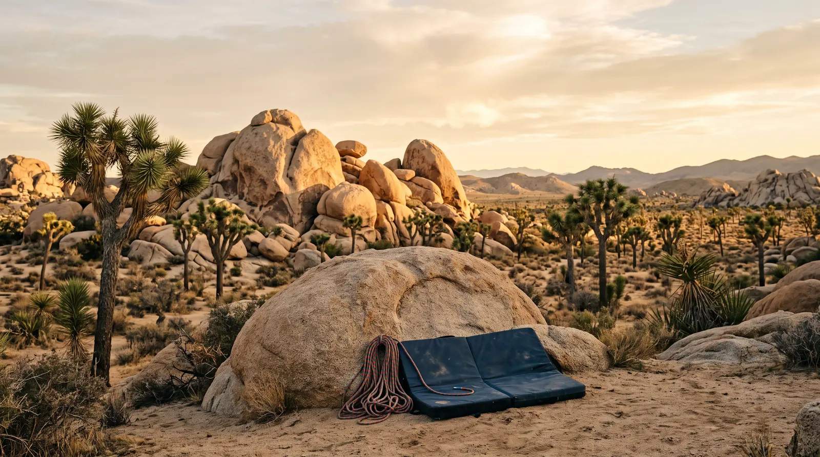
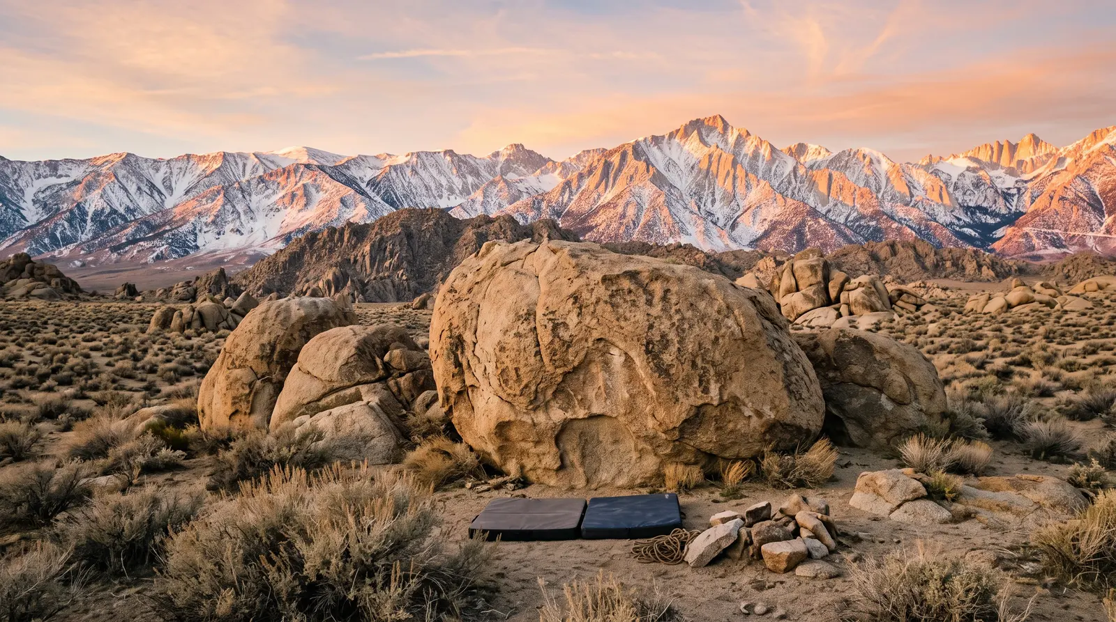
Bishop bouldering means two very different kinds of rock a short drive apart: the huge granite (quartz monzonite) boulders and highballs of the Buttermilks at about 1,950 m (6,400 ft), and the pocketed, steep volcanic tuff of the Happy and Sad Boulders on the Volcanic Tableland at about 1,340 m (4,400 ft). The season runs roughly October to April, with November and February usually the best months, and there are good problems from V0 to V13+. It suits everyone from first-time outdoor boulderers to strong climbers, as long as you have a car, crash pads and respect for some strict land rules.
I'm a strength and conditioning coach based in Prague, not a Bishop local or a climbing guide, so this guide is built from the land managers' own pages, the Bishop Climbing Rangers, Mountain Project and the current guidebook (all cited). It sits in our climbing trips and crag guides section. Rules and fees change, so check the official links before you go.
Bishop at a glance
| Buttermilks (and Pollen Grains) | Happy and Sad Boulders (Volcanic Tableland) | |
|---|---|---|
Rock | Coarse-grained quartz monzonite (granite-type) glacial erratics | Bishop Tuff: welded volcanic ash, full of pockets, huecos and edges |
Style | Tall faces, slabs, crimps and plates, famous highballs, flat sandy landings | Steep, athletic pulling on pockets in narrow canyons, caves |
Elevation | About 1,950 m (6,400 ft) | About 1,340 m (4,400 ft) |
Best for | Cool, dry days (autumn, late winter, spring mornings) | Cold winter days (sunny, sheltered), windy days at the Buttermilks |
Land manager | Inyo National Forest, mixed with private and utility land | Bureau of Land Management (BLM), Bishop Field Office |
Main camping | Dispersed camping on Forest land only | Pleasant Valley Pit Campground ("the Pit"), BLM fee site |
Grade spread | V0 to V13+, many classics V0–V7 | V0 to V10+, lots of V0–V6 |
Base town | Bishop, California (about 1,260 m / 4,150 ft) | |
Nearest airport | Eastern Sierra Regional Airport (BIH), seasonal United flights; bigger hubs: Reno and Los Angeles | |
Rest days | Owens River Gorge sport climbing, hot springs, the town of Bishop | |
Guidebook | Bishop Bouldering, James Lucas (Wolverine Publishing, 2024) | |
Granite vs volcanic tuff: why Bishop has two personalities
The Buttermilks sit in the foothills below Mount Tom, about 8 miles (13 km) west of town. Mountain Project describes the rock as quartz monzonite with blank faces, polished crimps and plates, sharp slopers and edges. The grain is big and rough, and it wears skin quickly, so a skin kit is not optional (see our climbing skin care guide). Many of the best-known lines are highballs, where a fall is long even with several pads.
The Volcanic Tableland ("the Tablelands") north of town is a plateau of Bishop Tuff, laid down by an eruption from the Long Valley Caldera roughly 760,000 years ago. Erosion cut canyons into its southern rim, and those canyons hold the Happy and Sad Boulders. The climbing is steeper and more about pulling on pockets and edges. The canyons trap the sun and block the wind, which makes them the go-to on cold winter days.
Two practical differences matter on a trip:
- Wet rock. The Bishop Climbing Rangers point out that the tuff is usually the last rock to get wet in a storm, but once it is soaked you should stay off it: water weakens volcanic tuff and holds can break. Wait until it has fully dried.
- Skin rotation. Granite friction tears the pads of your fingers; tuff pockets load individual fingers. Alternating areas spreads the stress, which from a conditioning point of view is the simplest way to climb more days in a row.
When to go: month by month
Bishop has a dry, high-desert climate: about 123 mm (4.8 in) of precipitation a year. These are the 1991–2020 averages for the airport in town. The Buttermilks are around 700 m (2,250 ft) higher, so expect them to be noticeably colder and more exposed to wind and snow.
| Month | Avg high / low in town | What it means for bouldering |
|---|---|---|
October | 25 °C / 3 °C (78 °F / 37 °F) | Season starts. Warm afternoons; climb early or late, or in the shade. |
November | 18 °C / −3 °C (64 °F / 27 °F) | Prime time at the Buttermilks. |
December | 13 °C / −6 °C (55 °F / 22 °F) | Short, cold days. Storms can bring snow to the Buttermilks; the sunny Happys are often best. |
January | 14 °C / −5 °C (56 °F / 24 °F) | Wettest month on average. Mixed weather; good friction on sunny days. |
February | 15 °C / −3 °C (59 °F / 26 °F) | Often excellent conditions everywhere. |
March | 20 °C / 0 °C (67 °F / 31 °F) | Still very good, warming up. |
April | 23 °C / 3 °C (74 °F / 37 °F) | End of the season. Bishop Visitor warns of heat by April; climb early morning and at sunset. |
May–September | 28–38 °C (83–100 °F) highs | Off season for bouldering. Rattlesnakes active. Climbers head to higher alpine areas instead. |
Storms can wash out the dirt roads, especially Buttermilk Road. Read the Bishop Climbing Rangers' weekly conditions report before each trip; it covers the Buttermilks, Tablelands, Pine Creek and the Owens River Gorge. If you are comparing winter options, our winter climbing destinations guide puts Bishop next to the alternatives.
Getting there and around
You need a car. The boulders are spread around town on dirt roads and there is no public transport to them. Eastern Sierra Transit runs buses along US 395 between Reno and Lancaster, which can get you to town, but not to the crags.
- Fly to Bishop (BIH). United Express flies from San Francisco and Denver, but only seasonally. Inyo County's current schedule lists San Francisco flights four days a week through 16 December 2026, then daily from 17 December to 28 March 2027; Denver flights run daily from 17 December 2026 to 27 March 2027 and five days a week until 19 April. The county airport page has the latest dates. Rent a car on arrival and check availability before you book.
- Fly to Reno or Los Angeles. These are the usual international gateways. From both you drive US 395 down (or up) the Owens Valley; plan on most of a day with stops and a grocery run. From the San Francisco Bay Area, remember that the Tioga Pass road through Yosemite closes for winter, so the drive becomes much longer during the main bouldering season.
- Las Vegas is another option for some travellers, via US 95 and US 6.
Road notes. Buttermilk Road (off Highway 168, west of town) is a bumpy, washboard dirt road. Mountain Project asks drivers to keep to the 25 mph limit, because locals walk and cycle on it and speeding worsens the ruts and dust. Bishop Visitor recommends a high-clearance 4WD and warns that winter storms can cut new ditches. For the Happy and Sad Boulders, take US 6 north from Bishop, turn onto Five Bridges Road and then Chalk Bluff Road (the BLM also lists a route via Pleasant Valley Dam Road). Chalk Bluff Road is a narrow dirt road; drive slowly and park only in the signed lots.
Where to stay
The Pit (Pleasant Valley Pit Campground, BLM)
The classic climbers' campground, close to the Happy Boulders. The BLM's current listing:
- $7 per site per night, credit/debit card only. No reservations: first come, first served.
- Stay limits: no more than 14 days at one campground, and no more than 28 days per calendar year across all Bishop Field Office campgrounds, unless the Field Office Manager gives written permission.
- About 75 tent and RV sites, each with a picnic table and fire pit. Toilets, but no drinking water, hookups or dump station. Fill up in town.
- Campfires only in the fire rings, and fire bans can apply in high fire danger. Call the Bishop Field Office on (760) 872-5000 if in doubt.
Camp at the Pit rather than dispersing across the Tableland, where the desert soil is fragile. Older blog posts quote $2 or $5 a night and longer stay limits; those figures are out of date.
Buttermilks dispersed camping (Inyo National Forest)
- Camping is allowed only on Inyo National Forest land. The Forest Service notes that the area is mixed with private and non-public utility land, and recommends a map app (such as Avenza with the Forest's maps) to check where you are.
- Do not camp at the Birthday Boulders or Peabody Boulders parking areas.
- Campfires need a valid California campfire permit and are only allowed when conditions allow.
- No trash service and no water. There are restrooms at the main parking area. Pack everything out.
In town
Bishop has motels, rentals and hostels, plus groceries, gear shops and cafés. A motel or rental makes sense in December and January, when nights regularly drop below freezing.
The climbing: main areas by level
Grades below are V-grades as listed on Mountain Project, with "R" marking a problem where a fall could be serious. Our grade converter turns them into Font grades, and climbing grades explained covers how the scales relate.
Buttermilks Main
The roadside hillside with the densest concentration of boulders, about 3.5 miles (5.6 km) up Buttermilk Road. Landings are mostly flat and sandy, but the boulders are tall.
| Level | Example classics (Mountain Project) |
|---|---|
V0–V2 | Robinson's Rubber Tester V0, Hero Roof V0, Buttermilk Stem V1, The Womb V1, The Hunk V2 |
V3–V5 | Birthday Direct V3, King Tut V3, Iron Man Traverse V4, Bowling Pin V4+, Flyboy Arete V5 |
V6 and up | Green Wall Center V6, High Plains Drifter V7, Soul Slinger V9 |
The giant Peabody Boulders (Grandpa and Grandma Peabody) are the landmark; their highballs are for experienced climbers with plenty of pads and spotters.
Pollen Grains (Lidija Boulders)
A quieter area on the north side of Buttermilks Main. Mountain Project describes it as about a 5-minute drive past the main parking (cross the cattle guard, go past the Get Carter Boulder, bear right uphill) and then a roughly 10-minute walk. Fewer boulders than the Main area, but much less traffic.
- Easier: Original Line V0 and Lidija's Mouth V3 (Lidija Boulder), Cover Me With Flowers V2 (Honey Boulder), Timothy Leary Presents... V2 (Hive Boulder).
- Mid-grade: Jedi Mind Tricks V4, Suspended in Silence V5–6 R, The Beekeeper V6 R, Drone Militia V6.
- Hard: Swanky Sit and Finders Fee V9, Golden Shower V10 R, Spectre V13.
Happy Boulders
The bigger of the two Tableland canyons, with more problems in the V0–V6 range. A pit toilet sits at the parking area. Mountain Project lists over 500 problems here.
- Easier: The Pursuit of Wow V0, Heavenly Path V1 (a tall one).
- Mid-grade: Black Magic V3, Ketron Classic V4, Serengeti V5.
- Harder: The Hulk V6, Mister Witty V6, Atari V6 R, Morning Dove White V7.
Sad Boulders
Further along Chalk Bluff Road, past the Happys. Smaller and quieter, and Bishop Visitor notes that more of it stays in the shade, which helps when the Happys get warm.
- Easier: China Doll V0.
- Mid-grade: The Fang V4, Molly V5, Strength in Numbers V5.
- Harder: French Press V6 (Misery Cave).
Beyond the big three
The current guidebook also covers the Druid Stones (more of the same granite, with a steep uphill approach), Rock Creek and the Sherwin Plateau. They are quieter, and worth a look once you know the main areas.
If this is your first time bouldering outside, start at the Happys or on the lower Buttermilks problems, and read outdoor bouldering for beginners and how to fall safely first. Highball grades tell you how hard the moves are, not how scary or dangerous the fall is.
Access, ethics and rules
Bishop's popularity has put real pressure on fragile desert soil and on Native American cultural sites. The Bishop Area Climbers Coalition set up a Climbing Ranger programme with the BLM and Forest Service to manage it, and the rules below come from the land managers, the rangers and Mountain Project's access notes.
Petroglyphs and cultural sites (Volcanic Tableland)
- Never touch petroglyphs. Mountain Project's Tableland page asks climbers to avoid all physical contact with them. Don't climb, chalk, brush, lean pads on or sit near any rock art.
- Don't touch or remove anything from archaeological sites, and don't share their locations. The Climbing Rangers stress this is prohibited by law.
- These places matter to the local Paiute community today. In one notorious case, thieves used ladders and power saws to cut petroglyph panels from a sacred Paiute site on the Tablelands; the panels were later recovered by the BLM, as Touchstone Climbing reported. If you see damage, report it to the BLM Bishop Field Office.
Soil, plants and restoration areas
- Stay on marked trails. At the Buttermilks, small green and tan signs mark restoration areas: keep out of them.
- Put pads on sand or rock, never on vegetation. Don't tie dogs to plants.
- Park only in designated spots and carpool when you can.
Waste and fires
- Pack out all trash, including tape and food scraps.
- Use the toilets at the main parking areas; elsewhere, carry and use a wag bag (human waste bag), as Bishop Visitor and the rangers ask.
- Fires only in established rings or with a California campfire permit where allowed, and never during fire bans.
Climber behaviour
- Brush off chalk and tick marks, keep groups and music low, and share popular problems (see our bouldering etiquette guide).
- Keep dogs under control and leashed: rattlesnakes are active in spring, summer and autumn in the Tablelands and Buttermilks.
- Join the rangers' Saturday-morning climbers' coffee (check the weekly report for the current time and place). It's the easiest way to hear current access news.
Gear to bring
- Crash pads: more than you think. For the Buttermilks highballs, several big pads per group are normal. See how many crash pads you need and our best crash pads guide. Gear shops in Bishop have traditionally rented pads, which is easier than flying with them; check availability before you travel.
- Skin kit: file or sandpaper, balm and tape for the coarse granite (how to tape fingers).
- A soft brush (brush guide), chalk, and a shoe-wiping mat.
- Warm layers and a down jacket. Desert mornings are below freezing much of the winter.
- Water and food for the day: there is no water at the boulders or at the Pit.
- Wag bags and a trash bag.
The full list is in our bouldering trip packing list.
If you are buying a pad for this trip, a large, thick pad is the natural fit for the tall Buttermilks problems. The Organic 5" Big Pad has a 45 x 58 in (114 x 147 cm) landing and 5 in (13 cm) of three-layer foam, per the maker. The drawback is its size and 20 lb (9 kg) weight, which is awkward to fly with; skip it if you only plan to climb the lower Happy and Sad problems, or rent locally instead.
Guidebooks and apps
The current comprehensive guide is Bishop Bouldering by James Lucas (Wolverine Publishing, 1st edition 2024, 456 colour pages). The publisher says it covers over 2,200 problems at the Buttermilks, Happy and Sad Boulders, Druid Stones, Rock Creek and the Sherwin Plateau, and that $1 from every copy goes to the Bishop Area Climbers' Coalition. Older guides by Wills Young and Mick Ryan (and the smaller Bishop Bouldering Select) are still around second-hand, but access notes in older books can be out of date.
Mountain Project is free and covers the main areas with access notes; 27 Crags and theCrag also list Bishop sectors.
Rest days, costs and safety
- Rest days: sport climbing in the Owens River Gorge, a soak in one of the area's hot springs, or a day in town. Your fingers usually need at least one full rest day after two or three days on coarse granite.
- Costs: camping at the Pit is cheap and Buttermilks dispersed camping is free, so car rental and fuel are usually the big costs.
- Emergencies: call 911 in the US. Phone signal can be patchy in the canyons. For a rattlesnake bite, call 911 and get to medical care quickly, keep the bite below heart level, and don't use ice, a tourniquet or "suck out" the venom (Bishop Climbing Rangers).
- Insurance: US medical and rescue bills are very high. Visitors from abroad should check their cover before travelling; see climbing travel insurance.
- Helmets for the sport areas: the rangers recommend them at Pine Creek and the Owens River Gorge because of rockfall.
A sample 7-day Bishop plan
A simple structure that alternates rock types to spare your skin (adjust to the weather report):
- Day 1: Happy Boulders. Easy pockets to shake off the travel, and set up at the Pit.
- Day 2: Buttermilks Main. Moderates and a look at the Peabodys.
- Day 3: Sad Boulders, shorter session.
- Day 4: Rest day: town, hot springs, laundry, file your skin.
- Day 5: Pollen Grains in the morning, Buttermilks project in the late afternoon.
- Day 6: Happys or Sads, depending on wind and temperature.
- Day 7: Buttermilks for your best friction day, then pack out every scrap of rubbish.
If you've never done a multi-day bouldering trip, keep each session shorter than you think: three or four hard days in a row is a lot more volume than most gym weeks. Our climbing warm-up and how to plan a climbing trip guides cover the rest. And if you have time on the way, Joshua Tree is the other big Californian winter destination.
FAQ
When is the best season for Bishop bouldering?
Roughly October to April, with November and February often the sweet spot. Town highs average about 18 °C (64 °F) in November and 15 °C (59 °F) in February. December and January can be cold or snowy at the Buttermilks, so climbers switch to the sunny, lower Happy and Sad Boulders. From May to September daytime highs in town average 28–38 °C (83–100 °F), which is too hot for good friction.
How much does it cost to camp at the Pit in Bishop?
The BLM's Pleasant Valley Pit Campground ('the Pit') currently charges $7 per site per night, paid by card only. There are no reservations. You can stay up to 14 days at one campground and 28 days per calendar year across all Bishop Field Office campgrounds. There are toilets and fire rings but no drinking water or hookups.
Can you camp at the Buttermilks?
Yes, but only on Inyo National Forest land. The area is mixed with private and utility-owned land, so check land status on a map app first. Do not camp at the Birthday Boulders or Peabody Boulders parking areas. Campfires need a valid California campfire permit and are only allowed when conditions allow. There is no trash service or water.
Can you climb near the petroglyphs on the Volcanic Tableland?
Treat every rock-art panel and archaeological site as off-limits. Mountain Project's area notes ask climbers to avoid all physical contact with petroglyphs, and the Bishop Climbing Rangers remind visitors that touching or removing cultural sites, or sharing their locations, is prohibited by law. Never climb, chalk, brush or place a pad near rock art.
Sources
- USDA Forest Service, Inyo National Forest: Climbing and Caving
- Bureau of Land Management, Pleasant Valley Pit Campground
- Mountain Project, Buttermilk Country (Bishop Area)
- Mountain Project, Volcanic Tablelands (Happy/Sad Boulders)
- Bishop Climbing Rangers / Bishop Visitor, Climbing Conditions Weekly Report (2026)
- Wikipedia, Bishop, California (climate normals 1991–2020)